GUNUNG · Malaysia
Mount Tahan
Gunung Tahan
Source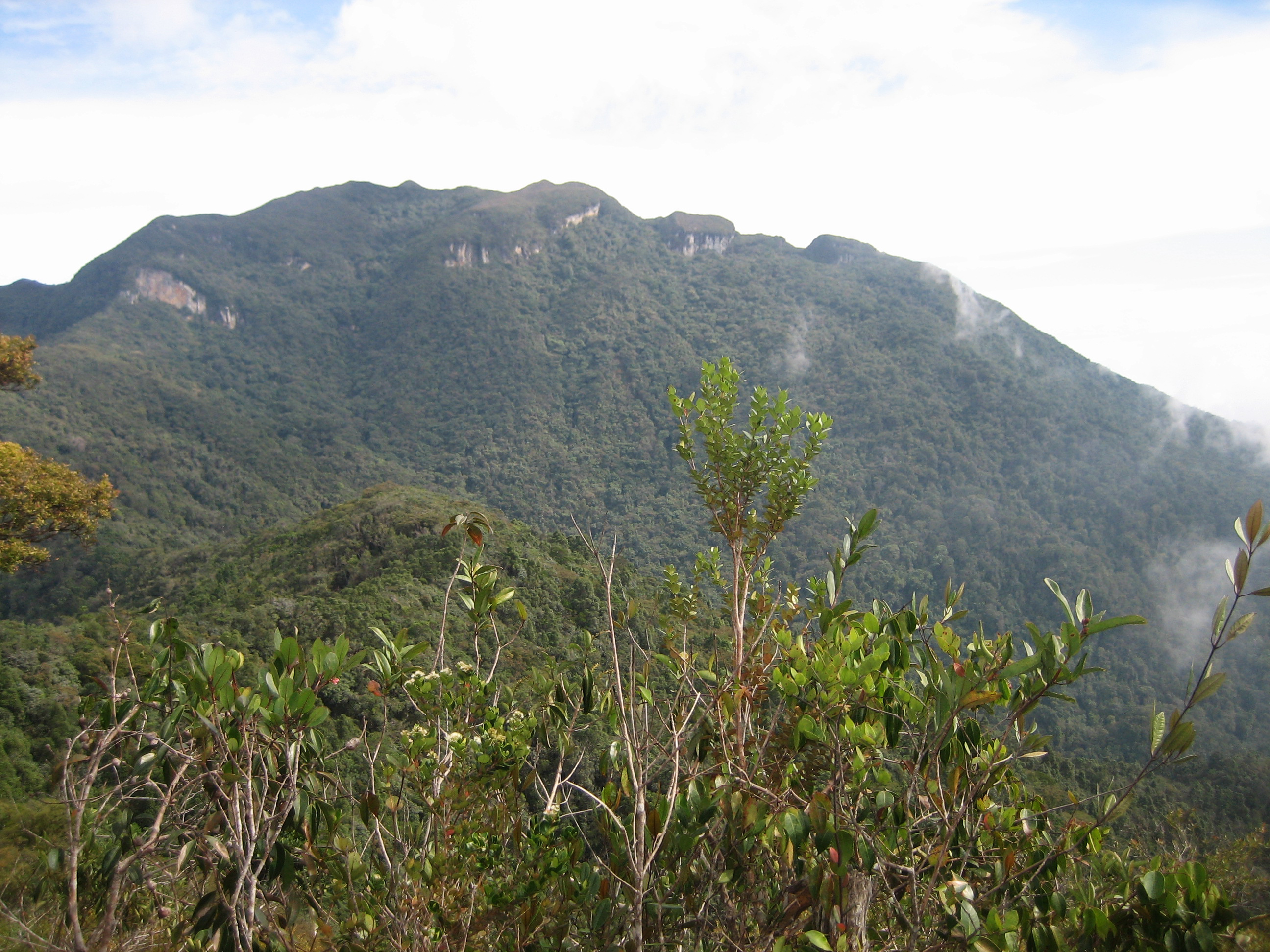
Photo: source
—
- Feels like
- —
- Humidity
- —
- Wind
- —
Source: Open-Meteo
Information
- Elevation
- 2.187 m
- Country
- Malaysia (MY)
- Location / Range
- Tahan Range (Tenasserim Hills)
- Mountain type
- Quartzite/sedimentary peak (non-volcanic)
- Volcanic?
- No (non-volcanic)
- Coordinates
- 4.6325, 102.2342
- Difficulty
- Very challenging (a long multi-day trek)
- Best Season
- February–September (outside the northeast rainy season)
- Permits & Rules
- Mandatory Taman Negara permit + registered guide; via Kuala Tahan or Merapoh
- Hazards
- Long and steep trek, river crossings, rain/leeches, remote with no signal
Description
Mount Tahan, at 2,187 metres, is the highest point in Peninsular Malaysia, on the Pahang–Kelantan border. It is the central feature of Taman Negara, Malaysia's oldest national park, and one of the toughest multi-day treks in the peninsula, requiring permits and a registered guide.
Gallery
Foto bersumber dari Wikimedia Commons — klik untuk memperbesar & lihat sumbernya.
Routes
Via Kuala Tahan
Sangat beratKlasik & panjang dari Pahang, menembus jantung Taman Negara.
Via Merapoh
BeratLebih pendek & populer, dari sisi Kelantan (Sungai Relau).
Climbing Experiences
The Mount Tahan trek (2,187 m), the highest point of Peninsular Malaysia, usually takes 4–7 days via Merapoh or Kuala Tahan through rainforest, river crossings, mossy forest and bonsai forest. Climbers rate it one of the peninsula's toughest treks due to wet terrain, leeches, rain and remoteness. A Taman Negara permit and guide are required.
References
The summary above is compiled from the following sources. Click to explore them yourself.